Get the Gettysburg, PA Inspiration Guide
Check out our Inspiration Guide online or have us send you one. Have an immediate question? Call us at 1.800.337.5015
Get the GuideThis Event Has Passed
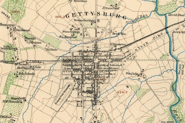
In 1747, the York-Nichol’s Gap Road was laid out (from east to west) through the Marsh Creek Settlement. In 1769, a north-south road was established from Baltimore to Shippensburg, and an intersection was created in front of the tavern of Samuel Gettys.
Eventually, a town was formed at the crossroads.
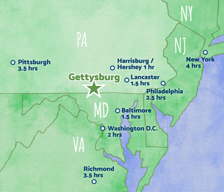
Gettysburg grew and prospered, and by the time of the Civil War, ten roads intersected at the town. It was this intersection that led directly to the army concentrating at this location in 1863.
Join historian Timothy H. Smith, as he discusses the “Roads to Gettysburg” in this free, public program.
Check out our Inspiration Guide online or have us send you one. Have an immediate question? Call us at 1.800.337.5015
Get the Guide